BASTAM
Excavations of the ancient
Urartian fortress Bastam
(Iran-Azarbayjan - 1969-1978)
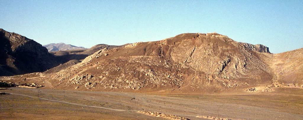
Bastam fortress after the last
season in 1978 |
|
|
|
|
Urartian kinglist
|
|
Bastam, ancient
name "Rusai.URU.TUR" or "Rusaipatari", Iran,
Western-Azarbaiycan (38° 53" N, 44° 57" E; 1300 m above
sea level): major Urartian fortress in the first half of the 7th
century BC
The modern village of Bastam is located some 50
km north of the city of Khoy at an altitude of 1300 m above sea
level. To the West the Turkish border is away about 50 km, to the
East Naxcivan is even closer. Around 100 km north of Bastam Mount
Ararat (Agri Dag) can be seen on clear days.
The ancient citadel is situated high above the village
on a steep mountain ridge on the left bank of the river Aq Çay,
as it enters the wide, fertile plain of Qara Zia Eddin. Several
channels were diverted from the river in antiquity, to irrigate
the adjacent plain. With it's situation on the western edge of the
plain the fortress not only controlled the plain but also a major
West-East-Route, running from the Urartian capital Tushpa (Van)
to Urartian territories in Azarbaidjan and Armenia. |
History
The place was settled already from the 3rd Mill. BC onwards, as excavations
within the area of the modern village showed. The area was part of Urartu since
the 9th century BC and a small fortress was built at that time, which was later
demolished, when the large citadel was planned. Bastam rose to prominence only
in the first half of the 7th century BC, when the Urartian king Rusa II.(Rusa,
son of Argishti, ca. 675-650 BC) reorganized his kingdom. Among the royal
residences Rusa II. built (Ayanis, Adilcevaz, Karmir Blur), Bastam was by far
the strongest. Next to Vankalesi (Tushpa) Bastam is the largest Urartian fortress
ever built. During Rusa's reign yet the fortress was conquered, burnt down and
not resettled again.

Discovery and excavation
The first information about the ancient fortress came from a
building-inscription, allegedly coming from the village of Bastam, which was
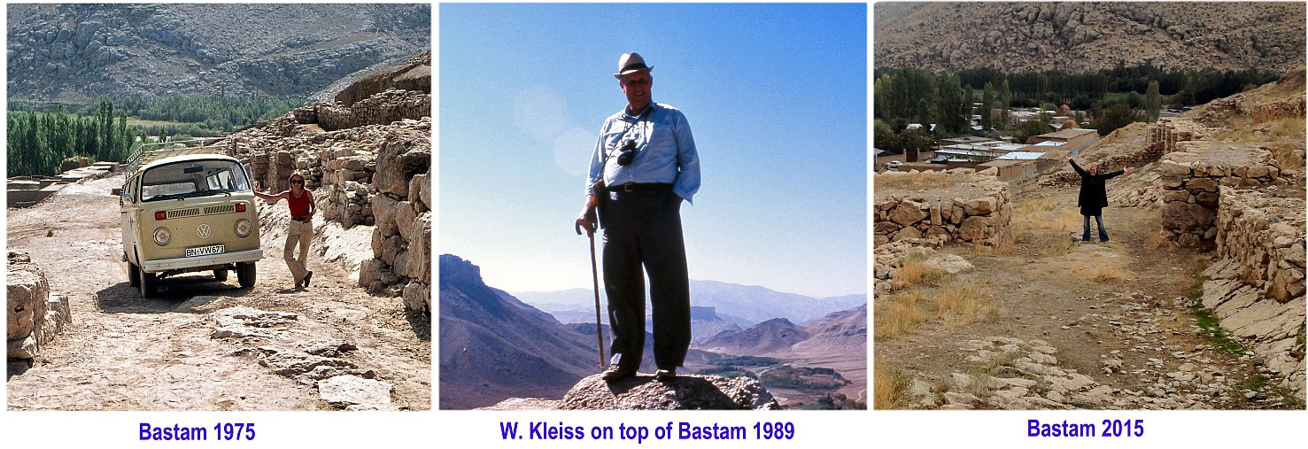
published in 1910. The actual site was discovered only in 1967 by Wolfram Kleiss
of the German Archaeological Institute in Tehran. Excavations were conducted
by W. Kleiss and S. Kroll with a team of archaeologists and experts from Germany,
Iran, Italy, the United States and other countries between 1969 and 1978.
In 1999 an archaeological team of Iran's Cultural Heritage Organisation (ICHO)
worked again at Bastam under the direction of Hamid Khatib Shahidi.
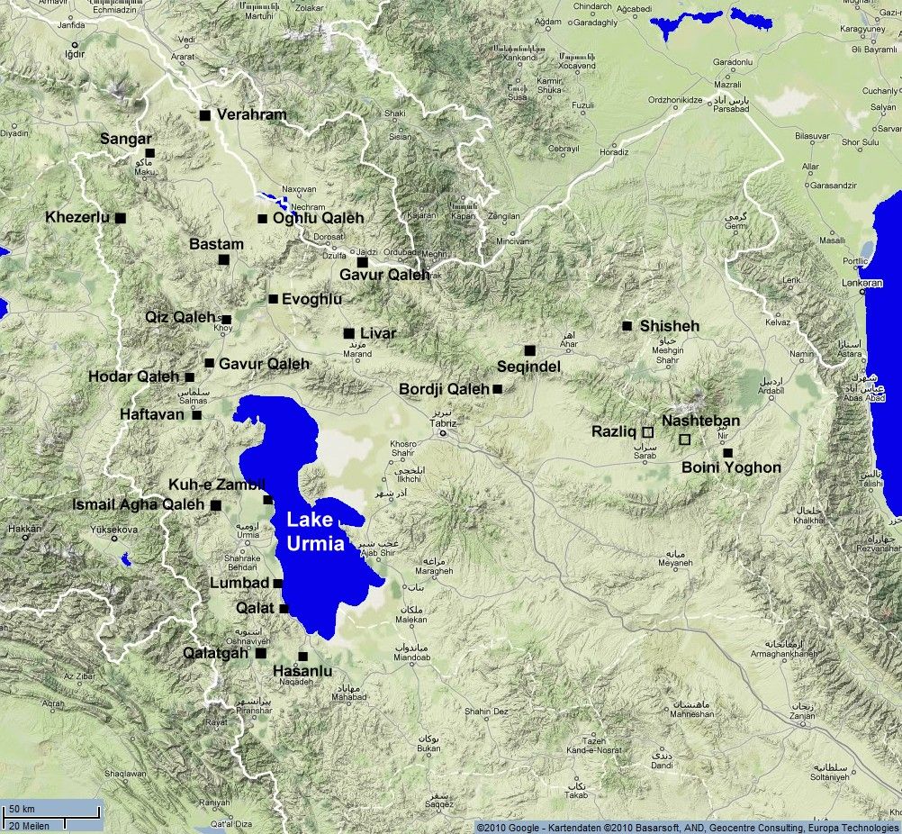
Map of north-western Iran with major Urartian sites
Excavation results
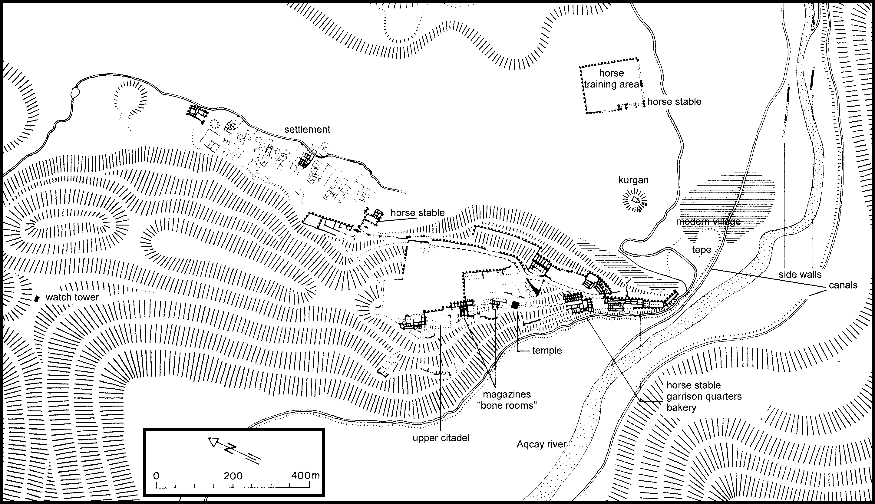
Over an area of approximately 800 by 400m Rusa II. built a fortress
divided into a lower, a middle and an upper citadel Fortification
walls were flanked with rectangular towers and buttresses. All structures were
built of sundried mudbricks on high stone foundations. The royal residence
was situated in the upper or northern citadel around 150m above the plain.
Several rooms were excavated up there, some fragments of painted wallplaster
could be found.
The middle citadel contained enormous magazines
with huge storage vessels to store grain, wine and oil. Other buildings contained
the burnt bone remains of more than 1500 animal carcasses. They might
have been stored as meat supply for wintertime. Together with the burnt bones
were found about 1500 clay-bullae with seal impressions of the king himself,
of princes and other high-ranking officials. Next to these magazines a square
platform was found, whereupon Rusa may have erected a tower-temple for the
Urartian God Haldi. Rusa II. mentions constructing a temple in the above
cited foundation-inscription. More fragments of other stone-inscriptions were
found there.
The lower or southern citadel consisted of lodgings for
the garrison and a horse-stable for about sixty horses; a mill,
a bakery and small magazines were also found. Cuneiform clay-tablets
containing royal letters were found together with bronze furniture-fittings
and iron weapons like a large lance-head. Among other finds were cylinderseals,
a rhyton in form of a gazelle's head and carved bone inlays. A gate flanked
by a tower gave access from the plain to the lower citadel.
In the plain at the foot of the fortress private houses and
some public buildings were found. Workmen and slave labour lived in huts or
pit-houses. As the settlement spread, more horse-stables and a corral,
the Eastern Building (Ostbau), were built. North of the fortress a second gateway
and another stable (Hallenbau) were built. From this gate now a fortified ramp
run directly to the upper parts of the fortress.

Plan of the Urartian Fortress Bastam (7th. century BCE)
Destruction
The end of the fortress must have come sudden sometime in autumn,
when all the storerooms were stocked up. As no victims have been found, the
fortress probably surrendered after a short siege, the population was led away
by the aggressors. All buildings were looted and set afire. Some so-called Scythian
arrowheads found in the destruction level and outside the fortification walls
could identify the aggressors, but more research is necessary to confirm this
possibility.
The place was not deserted completely. There is some indication, that a squatter
occupation continued for some time in the settlement. In the Median or early
Achaemenid period a small area near the so-called Hallenbau (Columned Hall)
close to the North Gate was resettled for a brief period.
Like many places in the area Bastam was resettled and fortified again in
medieval times, probably by Armenians, as coins and glazed medieval
pottery show. Afterwards the fortress site was left, only a small village near
the river went on into modern times.
email: Stephan.Kroll
Stephan Kroll 2004
last update 17-Oct-2019